Hope to see y'all at
SEMIANNUAL RANCH PARTY AND FALL FESTIVAL
-
OCTOBER 8 "Ranch" Party
 DIVERSITY
EXPERIENCE: celebrating
Diwali (Hindu+ Sikh Festival
of Lights), Halloween, All Souls, All Saints, Dia de los
Angelitos, Dia de los Santos Inocentes, Dia de los Muertos, Druid
and Wicca Samhain.....*
DIVERSITY
EXPERIENCE: celebrating
Diwali (Hindu+ Sikh Festival
of Lights), Halloween, All Souls, All Saints, Dia de los
Angelitos, Dia de los Santos Inocentes, Dia de los Muertos, Druid
and Wicca Samhain.....*more information on these festivals
-
-

-
COME IN COSTUME IF YOU CAN - BYOM (Bring your own bags of marshmallows); BYOB (unless you are satisfied with diet soda or bottled water)
come and go as you like
eat at 5 OR SO
There are at least six ways to get out to our place from Austin by car. Allow an hour or so to get there from Austin. (Another way is to by boat on Lake Travis to Arkansas Bend park and from there you are only a mile from our place. You can also camp at the park.)
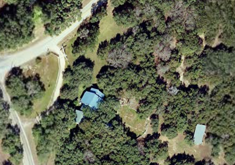
These are directions to 3305 Red Bird Trail during daylight (at night some landmarks will not be visible, such as the totem pole near our place).
SECTION I: FIVE WAYS TO GET TO HIGHWAY 1431
1.The obvious way and fastest way, except during rush hour: MoPac to 183 (going north and west) on to 183A toll road. (If you don't have TexTag they will mail you the toll bills.) Go the 1431 exit (Cedar Park) and turn left on 1431. At 1431 see below.
2.The fastest way avoiding toll roads: MoPac to 183 (going north and west). Go the last free exit (Lakeline Mall drive) and continue up the access road past Lakeline Mall Drive to Lakeline Boulevard.* Turn left on Lakeline Boulevard. Take it to 1431. Turn left on 1431. At 1431 see below. (*If you miss the Lakeline Boulevard turn, you can just go all the way up the old 183 to 1431 and turn left.)
3. The more scenic way: Campus to 2222.
[3A] Take the Northland/2222 exit off Mopac going north from Campus.
[3B] Or take 24th west (it becomes Windsor) across Exposition to the next stop sign, which is Pecos. Make a right on Pecos. Take it to its end on 35th street. Left on 35th (it becomes Old Bull Creek Road) to Mt. Bonnell Road. Right on Mt. Bonnell Road and take it to 2222.Left on 2222 (be careful).
When you get to the end of 2222 (at 620 near H.E.B.), get in the center lane (formerly the right lane) to go straight across 620 rather than turn at 620. Cross 620 rather than turning left. You will be on Bullick Hollow road. Take this til it ends at 2769. Turn right on 2769 and you will soon start going by what used to be Cypress Creek Ranch but is now a housing development and golf course, of course. Turn left on Dies Ranch Road to stay next to the development (just before the left turn, a sign says Dies Ranch Road + another sign says Austin Community College). At the stop sign at the end of the road make a left on North Anderson Mill. Take this to 1431. At 1431 see below.
Some other ways:
4.Take MoPac to Parmer; then go left to 1431 and make a left. At 1431 see below.
5.Or go up I-35 to 1431 (Sign for North Lake Travis and Chandler Road). At 1431 see below.
6.The longest scenic way, best if you have a sports car or a motorcycle for the turns: Campus to 2222 (Northland exit off Mopac). Or take 24th west (it becomes Windsor) across Exposition to the next stop sign, which is Pecos. Make a right on Pecos. Take it to its end on 35th street. Left on 35th (it becomes Old Bull Creek Road) to Mt. Bonnell Road. Right on Mt. Bonnell Road and take it to 2222. Left on 2222. Get in lane to go straight across 620 rather than turn right at 620. Cross 620 rather than turning left. You will be on Bullick Hollow road. Take this til it ends at 2769. Make a left -- you go through Volente -- and turn right on Lime Creek Road, which will take you to North Anderson Mill eventually (after many hair pin turns). Make a left at North Anderson Mill road and another left at 1431. At 1431 see below.
SECTION II: HIGHWAY 1431
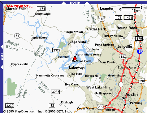
Whatever way you take, get on 1431 heading left (northwest) toward Jonestown, Lago Vista, the Lake, Marble Falls, etc..
After you go through Jonestown, you are only three miles from Lago Vista. Once you are in Lago Vista,
YOUR DESTINATION IS THE RED STAR:
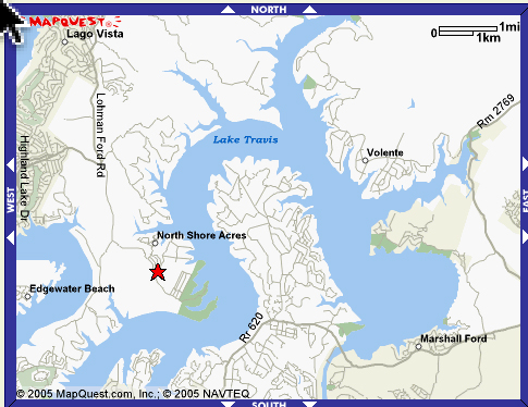
In Lago Vista make a left at the light by CVS pharmacy on Lohman Ford road. Go four miles, until you see a leaning brown sign on the right side of the road that says “LCRA/Travis County Arkansas Bend park.” On your left you will soon see
Make a left. You are on Sylvester Ford Road, entering the unincorporated area known as Arkansas Bend. (Ignore the blue dot in the picture below; your journey is down Sylvester/Cherry Lane past Patty Lane to Red Bird Trail):
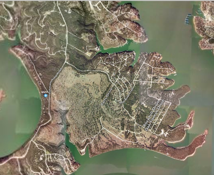
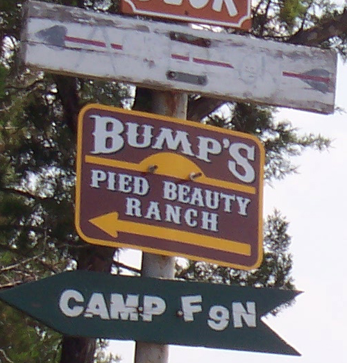
Go one mile. When you see a totem pole on your right (yes, the grotesque is everywhere) you are at the intersection with Red Bird Trail. You see our place on the left, with the longhorn flag and the Earth Day flag. Make a left and turn in the first driveway on the right, right after the large, -orange, adobe mail box, and drive under the Pied Beauty ranch sign. You made it!
Any problems call 267-7884 or 796-4970 or 699-1095.
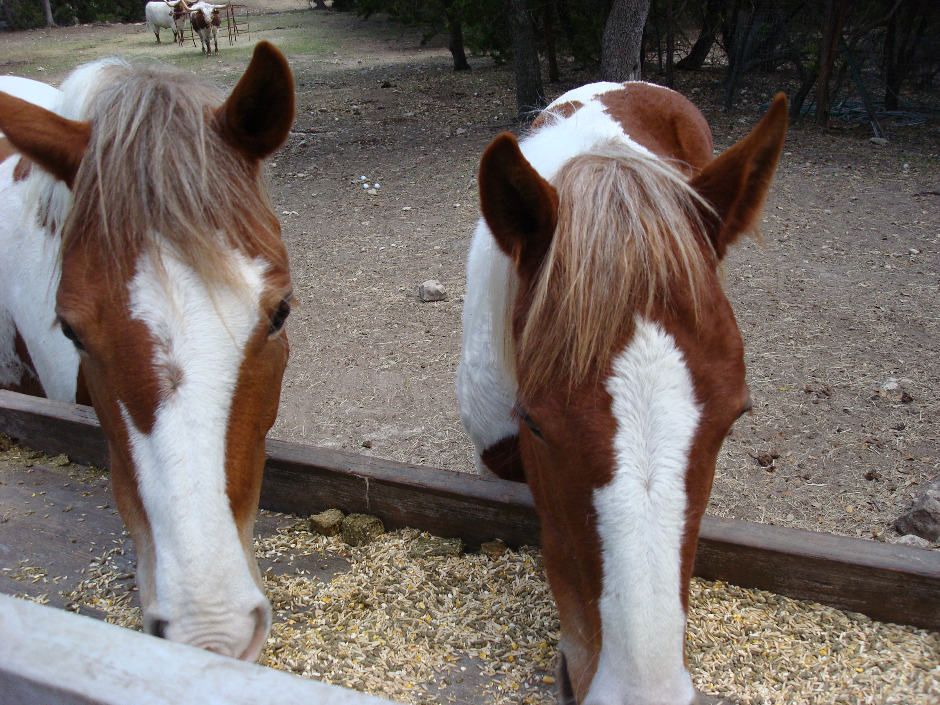
Mother and Daughter, the mustangs
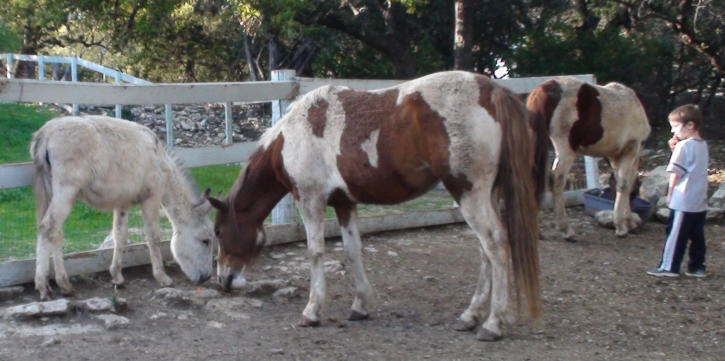
Zoe, the white donkey, and the mustangs
THE SPIRITS:
